Curiosity Rover Captures Flaky Rocks on Mars from Past Climate Change
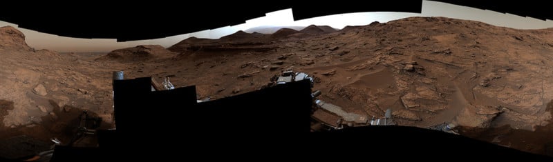
For the past year, NASA’s Curiosity rover has been moving between two regions in order to look for evidence of water in Mars’s past. Surprisingly, the area between the two target regions has provided fascinating details as well.
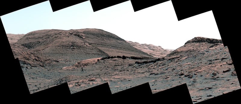
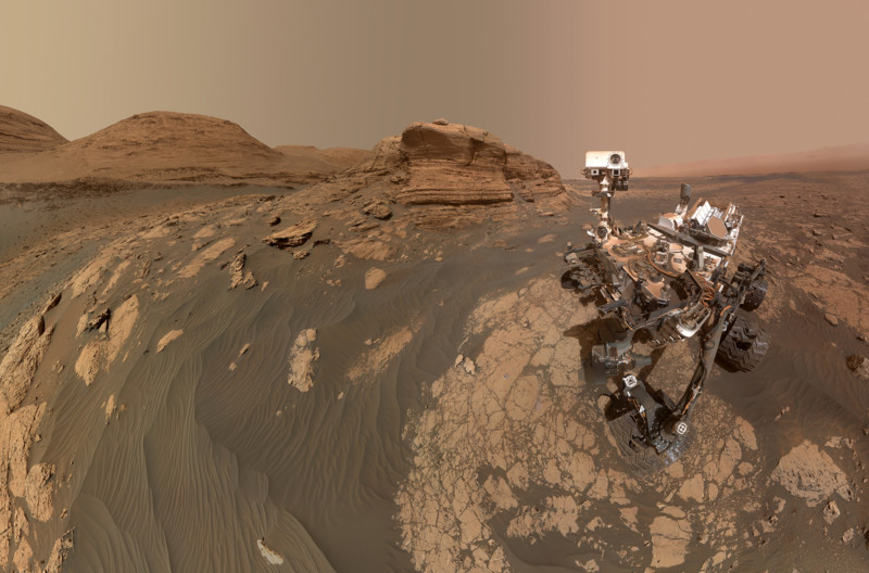
The science team has asked Curiosity to examine two areas, one rich in clay and one rich in a salty material called sulfate. For the past year, it has been moving from the clay region en route to the sulfate one, yet the transition area between them has yielded photos that show a record of a major shift in the planet’s climate billions of years ago.
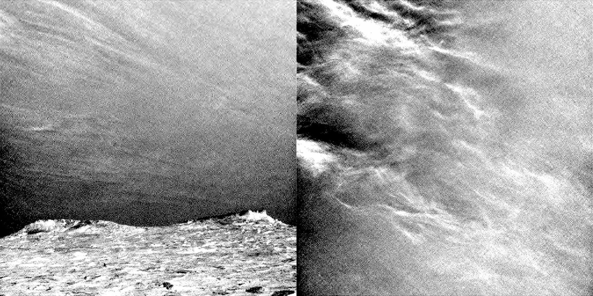
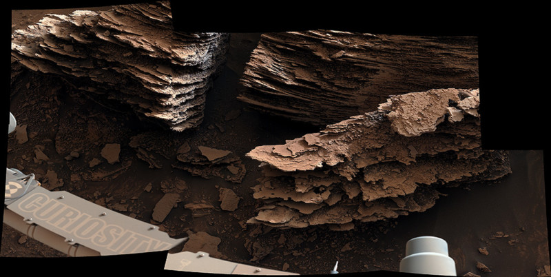
The flakey rocks that are visible in the photos are believed to have been formed by an ancient stream or small pond.
“We no longer see the lake deposits that we saw for years lower on Mount Sharp,” Ashwin Vasavada, Curiosity’s project scientist at NASA’s Jet Propulsion Laboratory in Southern California, says. “Instead, we see lots of evidence of drier climates, like dry dunes that occasionally had streams running around them. That’s a big change from the lakes that persisted for perhaps millions of years before.”
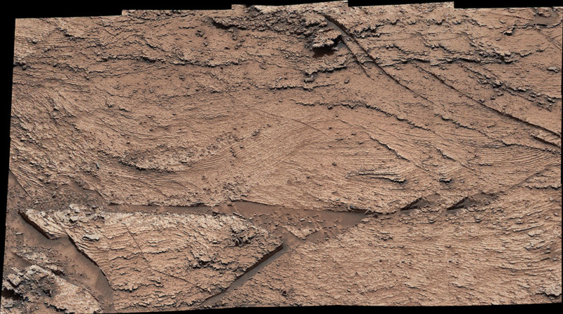
NASA says that as Curiosity climbs through the transition zone, it is detecting less clay and more sulfate in addition to unique geologic features. The scientists say that the hills in the area likely began in a dry environment of what they describe as large, wind-swept sand dunes that hardened into rock over time. Between them and in the remains of those dunes are other sediments that were carried by water, which NASA speculates were deposited in ponds or streams that once wove between the dunes.
The result is stacks of erosion-resistant “flaky layers” like the photo below, named “The Prow.”
Curiosity is Weathering the Test of Time
The Curiosity rover will celebrate its tenth anniversary on the Red Planet on August 5, and while it is still going strong there are definite signs of wear.
On June 7, the rover was switched into safe mode after a temperature reading logged a spike in the body that was warmer than expected. Engineers were able to return to normal operations two days later, but the exact cause of the issue isn’t yet known.
The rover’s wheels are also showing signs of wear. One of its middle wheels has newly broken grousers — its triangular-shaped, zig-zagging treads — and now has broken five of the 19 grousers on that wheel. Curiosity’s team has increased the number of photos the rover takes of its wheels so they can better monitor the issues going forward.
Despite these issues, Curiosity continues on its mission and nothing yet has been able to prevent it from carrying forward.
Image credits: NASA/JPL-Caltech/MSSS