Published on July 10, 2026
IAF World Space Award 2026
Find out this year's IAF World Space Award recipient!
The IAF World Space Award will be presented during the IAC 2026 Opening Ceremony on Monday 5 October 2026 for outstanding contributions in space science, space technology, space medicine, space law or space management of exceptional impact to the world’s progress in astronautics.
The IAF World Space Award for 2026 is bestowed to: International Charter 'Space and Major Disasters'
The International Charter ‘Space and Major Disasters’, or the Charter, is a worldwide collaboration among space agencies to make satellite data available for the benefit of disaster management authorities during the response phase of an emergency. By combining Earth observation assets, expertise, and resources from participating organizations, the Charter enables a rapid and coordinated response to major disasters, assisting civil protection authorities and the international humanitarian community. The Charter is uniquely positioned to mobilize space agencies worldwide, providing access to their expertise and satellite resources through a single access point that operates 24 hours a day, 7 days a week at no cost to the user.
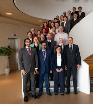
Team picture at the occasion of the 55th Charter Board meeting in April 2026, organised by the United Arab Emirates Space Agency (UAESA) and the European Space Agency (ESA) at ESA HQ in Paris, France.
Following the UNISPACE III conference held in Vienna, Austria in July 1999, the European and French space agencies (ESA and CNES) initiated the International Charter ‘Space and Major Disasters’, with the Canadian Space Agency (CSA) signing the Charter on 20 October 2000. Successfully operating since November 2000, the Charter has brought space assets into action for many natural and technological disasters including floods, hurricanes, tsunamis, earthquakes, landslides, wildfires, volcanic eruptions, ice jams, and oil spills. Since its inception, the Charter has been activated for more than 1035 major disasters across more than 146 countries, supporting responses to some of the world’s most significant crises. These include the 2004Asian tsunami, the 2008 cyclone Nargis in Myanmar, the 2010 earthquake in Haiti, the 2013 super typhoon Haiyan in the Philippines and Vietnam, the 2015 earthquake in Nepal, the 2017 hurricanes Irma and Maria in the Caribbean and USA, the 2018 earthquake and tsunami in Indonesia, the 2019 flooding in Mozambique, the 2023 Kahramanmaraş earthquakes that hit Türkiye and Syria, and Hurricane Melissa which struck Jamaica on 26 October 2025, among many others.
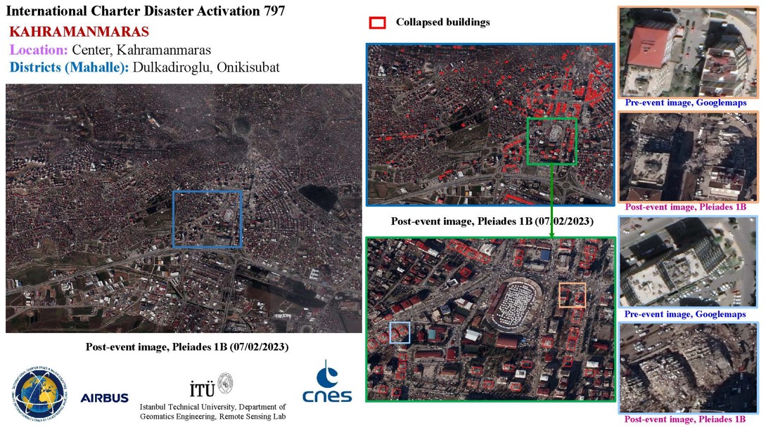
Collapsed buildings and temporary shelters in the centre of Kahramanmaraş, Türkiye, mapped using Pleiades satellite imagery acquired on 7 February 2023 following the earthquakes that triggered Charter Activation 797. Includes Pleiades material © CNES (2023), Distribution Airbus DS
The Charter can be activated by a predefined list of appointed users, known as ‘Authorized Users’ (AUs). AUs may request Charter support for emergencies occurring within their own country or in countries with which they cooperate on disaster response and relief efforts. Since 2012 the Charter has been working with partners, such as UNOOSA/UN-SPIDER, UNITAR/UNOSAT, and the Group on Earth Observations (GEO) to raise awareness of the Charter and its Universal Access Initiative. This initiative allows national disaster management authorities from any country to become a Charter AU. The Charter also cooperates with the Copernicus Emergency management Service (EMS) of the European Union, a global Earth Observation-based capability for disaster risk management. and collaborates with Sentinel Asia, a regional network for Earth Observation-based emergency response in 28 countries. Sentinel Asia’s partner, the Asian Disaster Reduction Centre, can submit Charter activation requests on behalf of Sentinel Asia users.
While the Charter’s primary mandate is to provide satellite data rapidly and free of charge, the Charter members collaborate with Value Adding entities worldwide, on a case-by-case basis, to provide valuable geoinformation products to end users. These products can consist of flood extent maps, infrastructure damage assessments, wildfire burn scar maps, oil slick estimations, lava flow delineations, landslide contours and more.
For differing disaster scenarios, the Charter provides the most appropriate satellite sensors and their processing options to be used to obtain the most useful data. For instance, optical images are well suited for damage mapping - medium-resolution (~10m) for an overview of overall impact, while higher-resolution acquisitions (up to 50cm) allow for detailed assessments of road networks and individual buildings. Synthetic Aperture Radar (SAR) imagery has an all-weather capability and is particularly adapted to key hazard types, such as floods, oil spills and landslides. When archived data is compared with newly acquired data, these change detection products offer further insights on how the landscape and infrastructure have been affected by a particular disaster. Together, these mapping products provide key information for areas that are difficult to access, helping to identify zones where aid is most needed. For each Charter activation, the Executive Secretariat of the Charter designates an individual or organization to serve as the Project Manager (PM). This role is filled on a voluntary basis and is central to the success of each activation. The PM coordinates the production of satellite derived information products and ensures their prompt delivery to the end user. The PM regularly communicates with the end user to ensure adequate support and service.
For more than 25 years, the Charter has demonstrated the strength of a durable international partnership, bringing together space agencies and satellite operators in a shared commitment to support disaster response efforts worldwide.
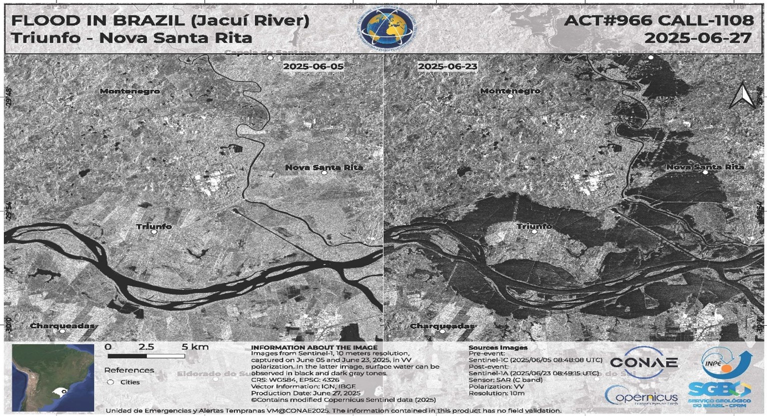
Illustration of a flood mapping product generated by INPE concerning Charter activation 966 requested by CENAD concerning severe flooding in the state of Rio Grande do Sul in June 2025. Contains modified Copernicus Sentinel data (2025)